Kitob District (Kitob Tumani)
Kitob District (Kitob tumani) is a district of Qashqadaryo Region in Uzbekistan. The capital lies at the city Kitob. It has an area of 1750 km2 and its population is 266,400 (2021 est.). The district consists of one city (Kitob), 13 urban-type settlements (Alaqoʻyliq, Bektemir, Rus qishloq, Baxtdarvozasi, Beshterak, Varganza, Obikanda, Panji, Sariosiyo, Sevaz, Xoji, Yakkatut, Yangiobod) and 12 rural communities.
The district is mainly located on the southern slopes of the Zarafshan Range. The population of the district is overwhelming Tajik, with the Kitob town being almost entirely inhabited by that ethnic group.
In 1979, the Kitab Zapovednik (Geological) reserve was established within the district. It has various protected flora and fauna. Flora includes; Tulipa ingens, Ferula moschata, Acanthophyllum gypsophiloides, Allium stipatatum, Crocus korolkowii, Tulipa turkestanica, Eremurus robustus, Colchicum kesselringii, Sternbergia fischeriana and Iris stolonifera. Birds found in the reserve include; Gyps fulvus, Aegypius monachus, Aquila chrysaetos and Gypaetus barbatus. Animals include Hystrix leucura (Indian crested porcupine), Canis lupus (Grey wolf), Vulpes vulpes (Red fox), Ursus arctos isabellinus (Himalayan brown bear), Martes foina (Stone Marten), Meles meles (European badger) and Sus scrofa (wild boar).
Map - Kitob District (Kitob Tumani)
Map
Country - Uzbekistan
 |
 |
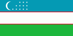
| Flag of Uzbekistan | |
The first recorded settlers in what is now Uzbekistan were Eastern Iranian nomads, known as Scythians, who founded kingdoms in Khwarazm (8th–6th centuries BC), Bactria (8th–6th centuries BC), Sogdia (8th–6th centuries BC), Fergana (3rd century BC – sixth century AD), and Margiana (3rd century BC – sixth century AD). The area was incorporated into the Iranian Achaemenid Empire and, after a period of Macedonian rule, was ruled by the Iranian Parthian Empire and later by the Sasanian Empire, until the Muslim conquest of Persia in the seventh century.
Currency / Language
| ISO | Currency | Symbol | Significant figures |
|---|---|---|---|
| UZS | Uzbekistan som | so'm or Ñўм | 2 |
| ISO | Language |
|---|---|
| RU | Russian language |
| TG | Tajik language |
| UZ | Uzbek language |


